How To Get GPS Coordinates From Google Maps To Your GPS Machine
- By: Tony Acevedo
- on
- Found In: Boating Tips, Fishing Tips, Weekly Newsletter: 5-3-20
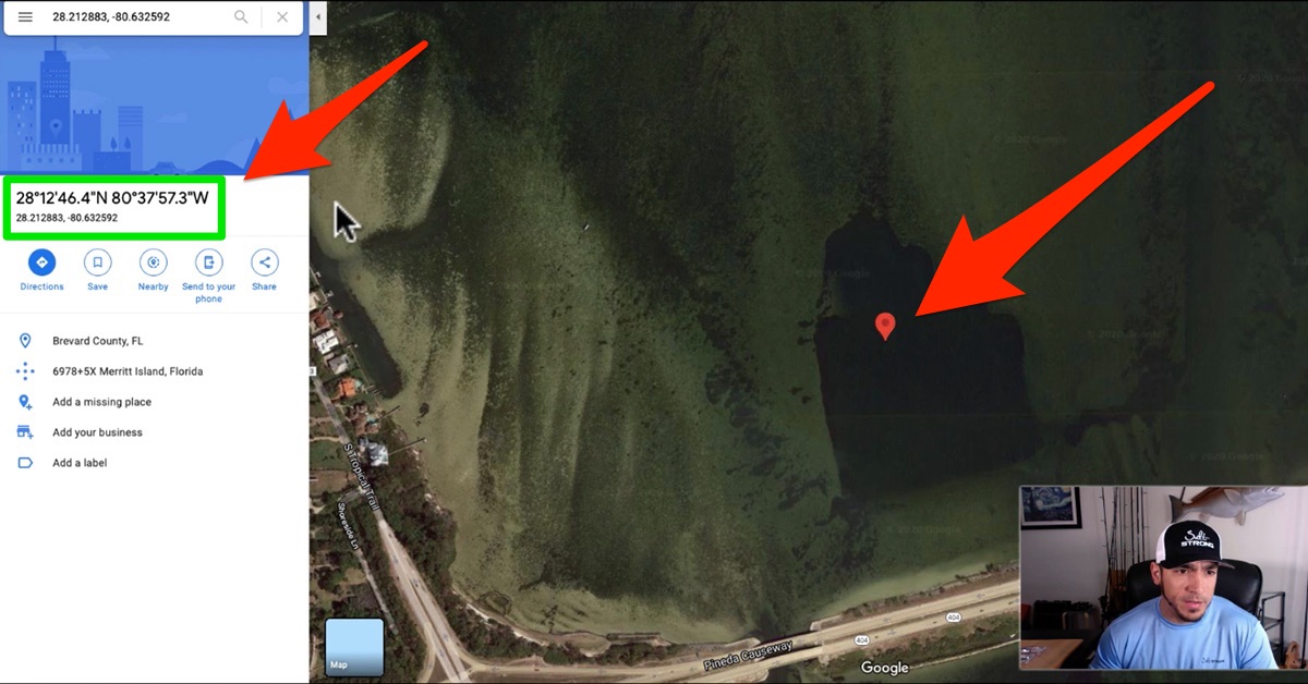
Here’s a question we got recently from one of our Insiders:
How do you get the GPS coordinates from Google Maps to your GPS machine?
Well, getting the GPS coordinates from Google Maps is easy…
One click and they’re on your screen.
But what about getting those numbers into your GPS?
Well, usually they’re in different formats, so in this video, you’ll learn:
- How to easily get the GPS coordinates from Google Maps
- How to convert them to the format required by your GPS machine
Let’s dive in!
How to Get GPS Coordinates To Your GPS [VIDEO]


GPS coordinates come in three different formats:
- Degrees, minutes, seconds (DMS)
- Degrees and decimal minutes (DMM)
- Decimal degrees (DD)
When you click on a spot, Google Maps gives you the coordinates in DMS and DD, and as luck would have it, most GPS machines require coordinates in DMM.
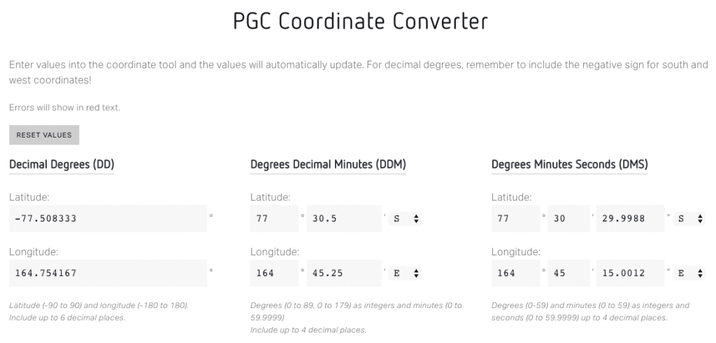
So how do you convert DMS or DD to DMM?
Enter the coordinates in any format into the website below to convert them to the other coordinates:
Have any questions about how to get GPS coordinates from Google Maps to your phone?
Let me know in the comments below!
And if you know someone who needs to see this tip, please TAG or SHARE this with them!
P.S. To get access to our best fishing spots and tips, plus discounts on fishing gear, click here to join us in the Insider Club!
Stop Wasting Time On The Water!
Do what the “SMART ANGLERS” are doing and join the Insider Club.
Here’s what you’ll receive today when you join:
- Weekly fishing reports and TRENDS revealing exactly where you should fish ever trip
- Weekly “spot dissection” videos that walk you through all the best spots in your area
- Exclusive fishing tips from the PROS you can’t find anywhere else
- Everything you need to start catching fish more consistently (regardless if you fish out of a boat, kayak, or land).
Click here to join today.
Related articles:
Related categories:
STOP WASTING TIME ON THE WATER!
Do what the “SMART ANGLERS” are doing and join the Insider Club.
Here’s what you’ll receive today when you join:
- Weekly fishing reports and TRENDS revealing exactly where you should fish every trip
- Weekly “spot dissection” videos that walk you through all the best spots in your area
- Exclusive fishing tips from the PROS you can’t find anywhere else
- Everything you need to start catching fish more consistently (regardless if you fish out of a boat, kayak, or land).






Does anyone know how to convert the old Baltimore County Metropolitan District (BCMD) grid system into the current Maryland state plane system or other modern coordinate system? My 1984 neighborhood plat contains the exact geospatial locations for all of my property’s corners, but I can’t make use of the information unless I can convert it somehow. Thank you!!
Thanks Tony for the tip, I had some numbers and been wanting to change over to the system for the boat GPS , But I haven’t made the time. I was able to quickly with your suggestion. Thanks!
Tony–It would be easier just to go into “Options” in GoogleEarth and set the Lat/Lon units to what you need for your on-board unit. Set it & Forget it.” Bill Woodhouse
check out map-gps-coordinates.com just type the address or point in the map to find the GPS coordinates