How To Find The Nearshore Depth Highway To Catch Big Fish
- By: Justin Ritchey
- on
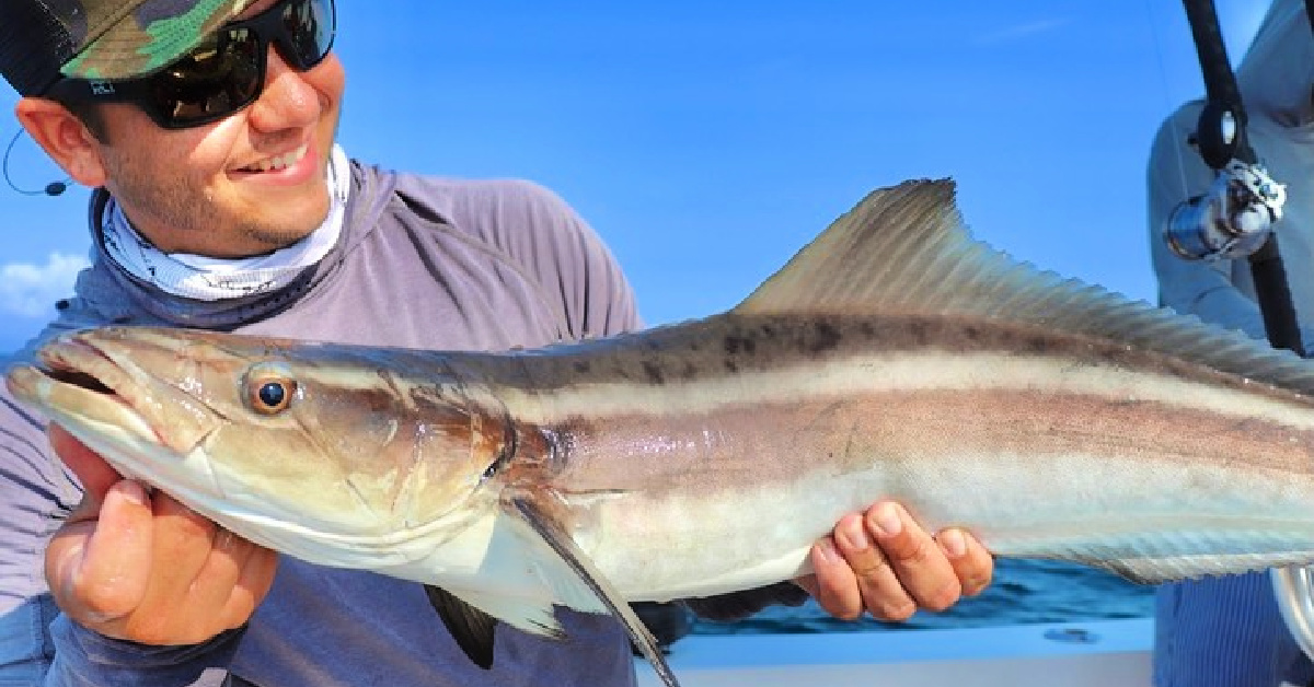
During the summer months, BIG fish are within just a couple of miles off of the beach.
I’m talking big tarpon, kingfish, cobia, tuna, and sailfish.
They are following bait school migrations as they head up the beach.
And if you want your chance at catching them, you need to know where the depth highways are and how to find them!
Learn the quickest way to identify these depth contours in this new video.
Check it out!
How To Find The Nearshore Depth Highway [VIDEO]

You can easily catch big fish in a small boat or kayak off the beach.
Most of the time fish orientate themselves to structure like natural reefs, wrecks, or rocks.
But sometimes you may be fishing an area that does not have any of these things and you’ll want to know what else you can look for to find fish.
How To Find Depth Highways Online
Go to Google and search for GPS nautical charts.
This site should show up first: click here for GPS charts.
Find your area and zoom in to see the water depths.
Try to find is the depth highways looking for different colors and where the depths change.
Find the distance to the depth of water you want to target by using the measuring tool.
Baitfish are going to be close to shore and those big fish are going to cruise in through the depth highways to feed.
Find a combination of baitfish schools and focus on depth changes and highways to find fish!
Conclusion

These pelagics move in shallow and follow temperature breaks and color changes in the depth highways.
Have you found the depth highways in your area?
Let me know down in the comments.
And if you know someone who wants to learn more about nearshore fishing, please TAG or SHARE this with them!
P.S. Want access to our best fishing spots and tips, plus discounts to our online tackle store? Click here to join us in the Insider Club!
Related articles:
Related categories:
STOP WASTING TIME ON THE WATER!
Do what the “SMART ANGLERS” are doing and join the Insider Club.
Here’s what you’ll receive today when you join:
- Weekly fishing reports and TRENDS revealing exactly where you should fish every trip
- Weekly “spot dissection” videos that walk you through all the best spots in your area
- Exclusive fishing tips from the PROS you can’t find anywhere else
- Everything you need to start catching fish more consistently (regardless if you fish out of a boat, kayak, or land).



Where is that tool that shows distance?
The Divider (Caliper Tool) is in the bottom Left hand corner of the site listed in the video (GPS Nautical Charts).
Nice video Justin !!! Nice tip
Thanks Pablo!
Anybody have trouble loading videos from Salt Strong? I timed it and after clicking this link to play, it took 14 minutes to load and start to play. Thought it was bc of an old phone but with new phone, same problem. Phenomenal info on the videos but frustrating to try to watch. Anybody have tips? Am I the only one?
Never a problem here.
close other apps on your phone. Make sure you’re on wifi if you’re in a spotty area for cell coverage. The videos are hosted on YouTube so they should be streaming ok. Hope this helps.
Good info, Justin. In central Florida, I don’t see many kings or sails caught in your half-mile zone but otherwise you’re spot on. It’s also an area than can hold reef fish (grouper, snapper) when bottom structure can be found.
Thanks Rob! The Sails are definitely down south (from about West Palm Beach down through Miami), but Kingfish are definitely abundant throughout the Central East Coast during the Summer Months, sometimes only 100 yards off the beach (I’ve had several friends bring in nice Kingfish standing from the beach throwing Plugs). Hope we get some more artificial reefs closer to land that hold nice Red Snapper soon!
Yet again great FREE information available to us thanks to advise from Salt Strong. Thank You! Bookmarked!
No problem, Joseph!
I’m in the Venice, FL area of the gulf. The biggest depth changes seem to be going from water that is around 6 to 8 ft to 20 ft in depth. So does that mean the depth highways would be a little closer to shore in a little shallower water than what you showed for Cocoa Beach? Or should I be targeting the area out a little farther (2 to 3 miles out) where there is generally a 5 to 10 ft drop from 25 ft to 30 or 35 ft in fairly short distance? Also, does it matter if you use live bait/mullet or frozen when trolling like this? Thanks for the post!
Great question, Jeffrey! You will definitely need to spend time in both types of drop off areas. Both of the examples you listed have a slope to them, and the Kingfish (in particular) could reside in either of those ranges. Obviously, find the bait if you have a fish finder, and you will certainly find Kingfish. But for Tarpon, for some reason I tend to find them on the Shallower-side of these edges, so I would concentrate more of your efforts closer to land for that species.
*And as for Live/Frozen Bait, I would ALWAYS prefer Live whenever possible. If you plan to “Bump” Troll, which is essentially bumping into gear forward and then bumping back into Neutral periodically, then Live Bait is hard to beat. But if you plan on covering a ton of ground, then yes a Frozen/Dead bait trolled at a moderate speed (3-4 knots) would be adequate.
Thank you so much for the help Justin! Very much appreciated!
Dude… killer info. Once again, thanks for clear and concise info. That was so digestible. I love you guys. (Christian love)
Haha I loved this comment! Christian love also!
Christian Love, Brothers!
When would you use this strategy on the gulf? Fall? Or summer as well?
This approach to dissecting Nearshore fishing will work best from Spring (mid to late April) all the way through Fall (October-ish). The Nearshore Species mentioned are most active from Spring through Fall, with Winter being a challenging period to target fish close to the beach because of cooler water temperatures and scarcity of baitfish.
I didn’t know that. Fine information. Thanks.
Glad you found it helpful, Curtis!