How To Read A Tide Chart (For Catching Fish AND Boating Safety)
- By: Luke Simonds
- on
- Found In: Fishing Tips, Inshore Fishing, WEEKLY NEWSLETTER: 10-18-20
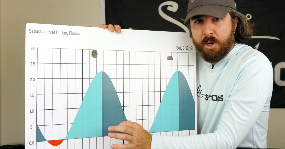
Do you know how to read a tide chart?
Although it can be confusing at first, it’s actually really easy.
And it’s important both because of safety reasons (you don’t want to get your boat or kayak stranded or run aground) and for catching fish (some areas are better at specific parts of the tide).
In this video, you’re going to learn:
- What the numbers on a tide chart mean
- What the slopes on a tide chart mean
- And more
Let’s dive in!
How To Read A Tide Chart [VIDEO]

Below is a screenshot from SmartFishingTides.com that shows the tides for Egmont Key near St. Petersburg, FL.
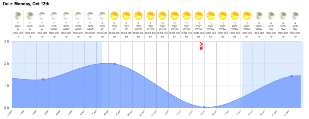
On the y-axis, you can see that the numbers go from 0 to 3 feet.
The 0 is the tide chart datum, which represents the low astronomical mean water level.
This just means that it’s the typical low water level mark.
Anything below 0 means that it’s an abnormally low tide, and anything above 0 is how high above the average low tide the water level is at any given point in time.
On the x-axis, the numbers are the hours in a day, so you can tell what the tide will be doing at different times in the day.
Now let’s look at a tide chart from Hilton Head Island, South Carolina:
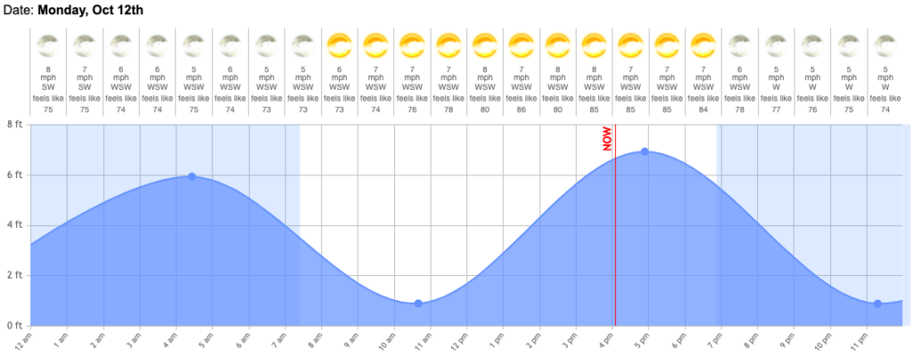
You can see that on the Gulf Coast of central Florida, the tide only swung from 0 to 2 feet today, but in Hilton Head Island, the tide swung from about 1 to 7 feet.
Tidal levels and changes are location-specific, but the good news is that the tide chart tools will do all of the calculations for you, so all you need to do is know how to read them (which you know now!).
Why Does Knowing The Tides Matter?
There are two main reasons why knowing the tides matters:
Reason #1: Safety
If you’re in a back creek in your boat fishing the outgoing tide, there’s a very real possibility that you could get stranded when the water goes all the way out.
So knowing when low tide is will help you avoid areas where you may get stranded.
Also, when you’re driving your boat over shallow water, knowing the tide is important so you know what areas to avoid.
Shallow bars or flats may be covered by just a few inches of water during some tides, so always be careful when navigating potentially dangerous areas.
Reason #2: Catching fish
Some areas are good at high tide, while others are good at low tide, and in order to know what the tide will be doing, you need to know how to read tide charts.
Also, fish usually like to eat when the current is moving.
You can tell how fast the current is moving by the slop of the line in the pictures above.
The greater the slope, the faster the current.
Conclusion
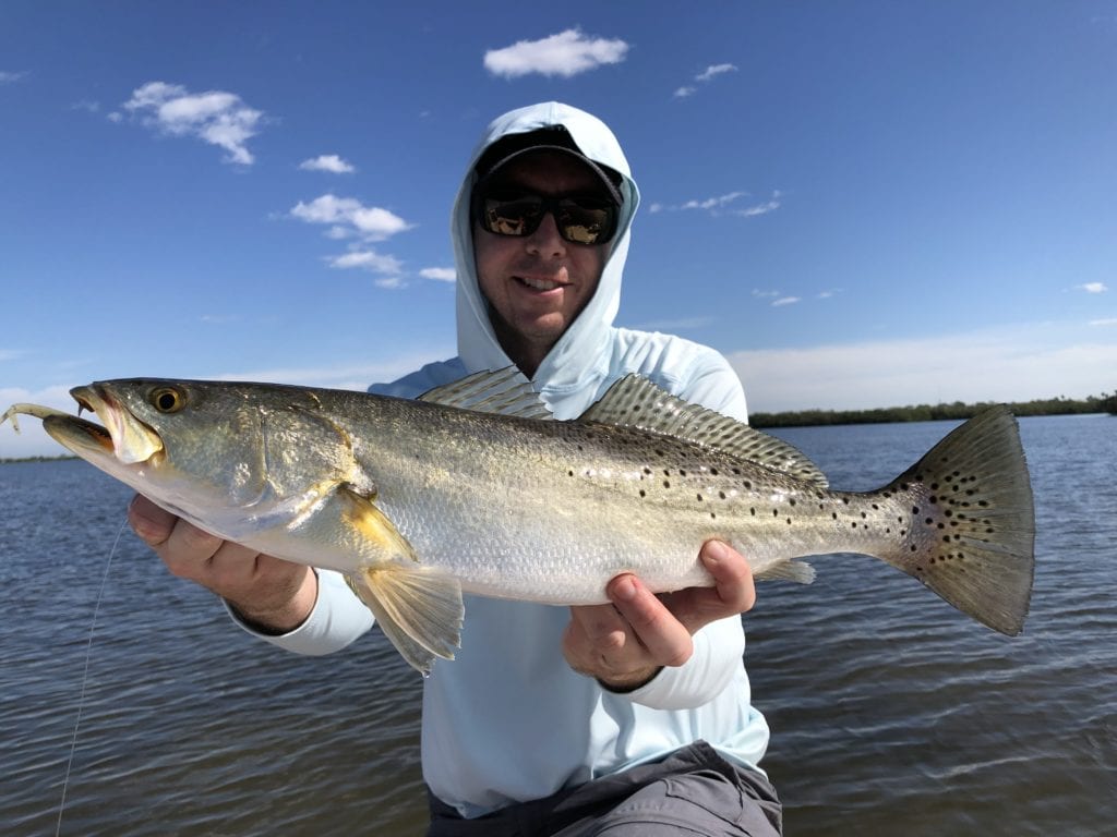
To catch more fish and stay safe on the water, knowing how to read tide charts is very important.
The 0 on the y-axis is the average low tide, while the numbers above it show how high the water is above the average low tide.
The numbers on the x-axis are the hours in a day.
And my favorite tool for getting tide charts online is SmartFishingTides.com.
Have any questions about reading tide charts?
Let me know down in the comments.
And if you know someone who needs to learn how to read them, please TAG or SHARE this with them!
P.S. Want access to our best fishing spots and tips, plus discounts to our online tackle store? Click here to join us in the Insider Club!
Related articles:
Related categories:
STOP WASTING TIME ON THE WATER!
Do what the “SMART ANGLERS” are doing and join the Insider Club.
Here’s what you’ll receive today when you join:
- Weekly fishing reports and TRENDS revealing exactly where you should fish every trip
- Weekly “spot dissection” videos that walk you through all the best spots in your area
- Exclusive fishing tips from the PROS you can’t find anywhere else
- Everything you need to start catching fish more consistently (regardless if you fish out of a boat, kayak, or land).



It should go without saying, a person should drive a boat slowly, in unfamiliar water.
Two days ago, I watched a boat leave the dock and immediately run upon an oyster bed, only 200 yards away, while traveling at least 25 miles per hour.
Luckly, no one was hurt,and the tide freed them 3 hours later.
Yes, it’s very smart to be extra careful when in unfamiliar waters.
Great refresher! You mention “fish usually like to eat when the current is moving”. Is it a good rule of thumb that the bite is better from ~2 hours before to ~2 hour after the tide change? I’ve been told that too strong of a tide, the fish take cover. Or maybe that depends on what you’re targeting (around Tampa Bay).
Depends on where you’re fishing… on the flats, the best time (other than twilight) is when the current flow is moving as at its peak speed (which still isn’t very fast). But in the passes/inlets where the current flow really moves fast, it can be very tough to fish during peak current so the best time to fish is often when the current is in between its peak flow and slack.
Do you have any general rule of thumb knowledge of tide time differences between the inlet vs. the distance of how far you are fishing from the inlet inshore. Example if you were fishing 7 miles inshore from the inlet how far behind would the tide be running at that point vs. the inlet tide schedule?
That’s a tough one… there is definitely going to be a lag, but every areas is different because it depends on how many funnel points and obstructions the current has to go through/around.
Excellent refresher Luke! we all need to be reminded occasionally. Thanks.
Thanks Buddy!
Thanks, Luke. Great lesson especially for me fishing the often-challenging waters around Cedar Key. So do I understand you correctly that the numbers I see on my chart-potter represent the depth at absolute zero low tide?
The depth numbers are based on the chart datum, which is the mean low water mark.
I have a basic understanding of the factors that cause tide level fluctuation. However, are there factors that impact the normal duration of the tide cycle (high tides occur 12 hours and 25 minutes apart)? With respect to time duration, I was told tide charts reflect hypothetical times but don’t account for conditions that could impact it. For example, high winds coming onshore may push water inshore causing the actual high tide to be longer in duration as well reaching a higher height. Do you have any insights? Thanks.
The tide charts predict the tides based on the gravitational forces of the Moon & Sun which are often the biggest drivers of tidal flow. So they’ll be perfectly accurate assuming that the weather-based factors are not altering the tidal movements.
The core weather factors that often impact the tide and currents of our inland waterways are changes in wind speed/direction, air pressure, and recent rainfall… details on how to account for these factors are in this lesson in the Finding Spots Mastery course: https://saltstrongdev.wpengine.com/spotsmastery/bonus-material/understanding-tide-currents/
Thanks, Luke.
Thanks Phil!