Have you gotten the chance to plan a trip using Smart Fishing Spots yet?
Smart Fishing Spots is the ONLY fishing app you will ever need again.
Check out how to plan a trip by using this platform below!!
Plan A Fishing Trip Using Smart Fishing Spots [VIDEO]
 Join the Insider Club TODAY and get the Best All-In-One Fishing App for FREE
I am back in East-Central Florida looking at the map for some fishing spots!
My area of interest for this trip is the Indian River Lagoon and nearby waters.
As a kayak fisherman, the two most important things to me are going to be the wind and the overall weather forecast.
That means the direction of the wind as well as wind speed and if there are potential thunderstorms or other weather systems in the area.
These factors help me determine which side of the river I should launch from.
Planning A Trip
To begin, I open up Smart Fishing Spots and it will display the direction of the wind as you first open it up.
Then, using the toggle bar down at the bottom of the screen, I drag the time to about the time I will be out on the water.
In this case, that is around 6 am.
Next, I need to know the weather forecast for the morning.
The top row of Smart Fishing Spots indicates the upcoming two-week weather forecast.
You can further click into each day to learn more about the weather and other factors.
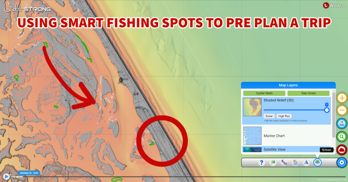
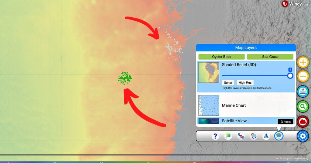
Recently, we made some updates to Smart Fishing Spots and you can now reveal all of the oyster bars and seagrass beds in your area with the click of a button.
Not to shift gears, but the Indian River Lagoon has been the subject of immense seagrass loss due to a number of factors.
Seagrass is an important part of marine ecosystems and oftentimes for fishermen, they mean there are fish nearby!
On the bottom left-hand corner of Smart Fishing Spots, click the Gear icon and then select the first option closest to the right that will open up the map layers.
Here you will see “Oyster Beds” and “Sea Grass” options at the top to click on.
When you click on these buttons, all oyster beds in the area you are looking at will show up in grey and all seagrass beds will show up in green.
[optin-monster slug=”wcrcrc7d6ih5k29wooi4″ followrules=”true”]
Conclusion
Smart Fishing Spots is a one-stop-shop for you’re entire fishing trip pre-plan, on-the-water adjustments, and post-trip analysis.
If you are an inshore saltwater angler, then you have to get your hands on Smart Fishing Spots!
What are you waiting for? Join the Insider Club TODAY and start using Smart Fishing Spots to crush fish this summer!
Do you have any questions about how to plan a trip using Smart Fishing Spots?
Let us know what you think of the app and its features down in the comments!!
If you know someone who wants to learn more about how to plan a trip using Smart Fishing Spots, please TAG or SHARE this with them!
Oh, and by the way, want FREE access to Smart Fishing Spots? Click here to join us in the Insider Club!
Related Articles:

Great!
How can I get this app in my boat and on the water when I go out.
Roger, if you open up the Salt Strong Community and then click on the menu in the upper right hand corner, a drop down menu will open up. From there you can click on “Smart Fishing Spots”. That will take you to the app.
Enjoyed the video, any idea when SE Georgia will be included.
Terrific tool, Pat! I’ve found it be be very useful lately!
Great video Pat!
Great stuff Pat. This should help a lot!
Awesome stuff, Pat
Thanks Joe!
This new app is great! Wondering when oyster shells and sea grass will be available for alabama and Ms. Sound? Thanks.
It’s a work in progress. LOTS of data to find and then get into the system (but it’s all coming)
Glad you like it! So much info is being loaded right now. I’m sure it will be soon for your area.
Really good post Pat! Saving this one for future reference.
Glad you liked it Mark!
I fish in Galveston bay complex, along the ship channel up stream by the San Jacinto Monument and further as it turns into a barge channel, will you have High Res further up the barge channel? I also noticed that High Res on the Houston ship channel doesn’t extend out to the spoil banks along the channel, will that change in the future? Just joined and I think your site is great, I thought I was a pretty good fisherman but your site has really opened my eyes. Thanks
Thanks for becoming a member Dwight!
As more data is released from each the the site will just get better and better. This is just phase one and two wait until you see what else is coming!