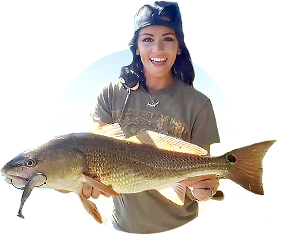
Smart Fishing Spots is………HERE!!!!!
Yup, the ultimate all-in-one fishing app is live!
Here are just a few things this new fishing app gives you:
- Sonar (depths at every area)
- Radar
- Satellite maps
- Wind (with our partner Windy)
- Weather
- Rain
- Clouds
- Tides
- Waves
- Best time to fish
- Tracks
- 3D Underwater topography view
This new app is something you will definitely want if you’re into saving time and money!
Check more out below!!!
Underwater View Of Your Fishing Spots [VIDEO]
 Click Here To Join The Club And Get This APP for FREE
The Smart Fishing Spots App has been released to our Insider Members!!!
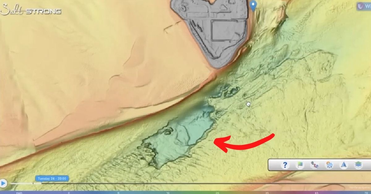
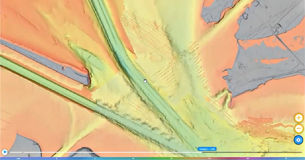
This is the first time we have ever seen an intricately defined bottom contour on a map.
Here are timestamps to follow along:
- 0:00 – Smart Fishing Spots is finally HERE!!!
- 0:25 – Boca Grande Example of Shaded Relief Layer Mapping
- 1:36 – Features & Data included in the app
- 3:55 – Shaded Relief (3D) Layer Maps
- 6:07 – The Goal of Smart Fishing Spots
- 7:11 – Insider Members Only
- 8:46 – How To Plan A Fishing Trip using this software (Walk-Through Example)
- 11:16 – Sonar Maps & Marine Charts
- 12:33 – MUCH MORE TO COME!
- 13:07 – Join the Insider Club TODAY
[optin-monster slug=”wcrcrc7d6ih5k29wooi4″ followrules=”true”]
Conclusion
It has finally ARRIVED!!!
If you are a current Insider Member, head out and start using our brand new platform and let us know what you think!
If you are on the fence about joining the club, this is your last chance to join before membership prices increase!!!
This is going to change the way we all plan our fishing trips.
Do you have any more questions about our all-in-one fishing app?
Let us know your thoughts and comments down below!!
And if you know someone who wants to check out the ultimate all-in-one fishing app, please TAG or SHARE this with them!
P.S. Want access to our best fishing spots and tips, plus discounts to our online tackle store? Click here to join us in the Insider Club!
Related Articles:


I am already a member. How do I get this app?
You have full access to it here: https://community.saltstrong.com/SFS/
This app is web-based so that you don’t have to download anything.
can not get in baffin bay
This app is a game changer for all fishermen and fisherwomen.
JohnMartin here sure wish to get is app on my phone asap
red Tide is so bad now , dead fish on the Englewood beaches
Way too confusing. Makes no sense…lucky I could write back.
U need instructional vedio as most of the time I can not function with salt strong….totally not tech savey.
Don’t worry I’ll still make ur namebadges. Ray
Do the smart fishing spots cover NC
Absolutely! We have a lot of members in NC so there are many smart spots along the entire coastline.
Will there be an option to find/use the solarlunar calendar for fishing? The one that I am using now is: https://www.fishingreminder.com/#google_vignette
Just wanted to voice my opinion. This club is the real deal .you two brothers have what all companies should do for their customers you treat us as you would like to be treated thank you very much you both hold my highest respect. My main problem is that I didn’t join the club four years ago when I first started watching salt strong I did buy several fishing shirts from salt strong though. I was just a little leary about joining fishing clubs because about twenty five years ago I joined and paid for a lifetime membership in the North America fishing club then after about ten years it just disappeared with no warning and no information on what happened to it still to this day me and hundreds of members still have no answers. Just wanted to say to anyone not sure weather to join this club (sat strong) or not I will say don’t hold back just in the short time I decided to become a member it’s a real deal I am just a member and have no other affiliations to this club other than just a member so don’t hold back join today you won’t be dissatisfied thanks salt strong
We appreciate you big time, Donald. We’re certainly blessed to have you in the Salt Strong family.
Do all members get this app if so where and how do you access
Yes sir. Simply go to http://www.saltstrong,com (while logged in) and you’ll see the place to download it towards the bottom of that page
do the maps cover the northeast? Long Island Sound specifically?
Yes sir!