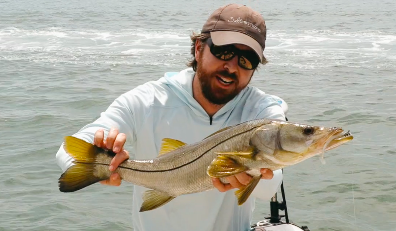
You’ve got to see these two new Google Maps features that will help you find new fishing spots faster than ever before!
Google Maps has always been helpful for finding spots…

You can see above-water structure, proximity to inlets and passes, and, if the water is clear enough, you can even see underwater structure like grass and depth changes.
But these two new features we recently discovered have taken things to a whole new level!
They’re a gift to all fishermen who don’t have time to spend every day on the water scouting out spots and in this new podcast, Luke is going to walk you through each of these new features and how to use them to find new honey holes.
These tips will help you catch fish no matter where you live or what type of vessel you fish from (and they’re especially helpful for land-based anglers!).
You can watch the video version of this podcast below (which I definitely recommend since Luke shares his computer screen and demonstrates using these new features), listen to the audio version by clicking the play button underneath it, or listen to it on iTunes, Stitcher, or Spotify.
P.S. Don’t forget to subscribe on iTunes, Stitcher, or Spotify and leave us a review!
New Google Map Features To Find Fishing Spots [VIDEO]
 Click here to join the Insider Club
New Google Map Features To Find Fishing Spots [PODCAST]


Note: Don’t forget to subscribe to the Salt Strong podcast on iTunes, Stitcher, or Spotify and leave us a review!
Click here to join the Insider Club
Related Podcasts:
- THE ULTIMATE PRE-TRIP PLANNING BLUEPRINT (USING ONLINE MAPS)
- HOW TO FIND 90% OF ALL FEEDING FISH IN YOUR AREA (90/10 FISHING RULE)
You can visit Google Maps at https://www.google.com/maps/.
Now let’s dive into how to use it to find fishing spots.
Using Street View on Google Maps
Street View isn’t just for streets anymore.
Now you can use it on:
- Beaches
- Jetties
- Piers
- Nature trails
- And more
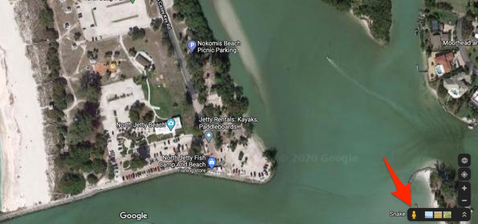
To use Street View, just click and drag the little man the arrow is pointing to in the picture above and place him wherever you see a blue line or dot.
You can use this to:
- Find kayak launches
- Find water access for wading
- And even read street signs to see things like if fishing is allowed on certain bridges
Using Waterway View on Google Maps
Not only can you use Street View to see the view from land, but you can also use Waterway View to see the view from the water.
How crazy is that?!
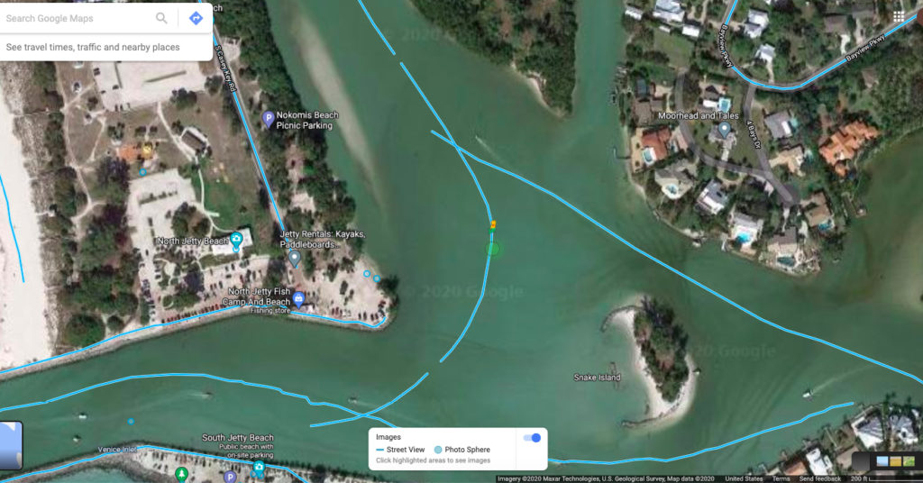
To use Waterway View, just drag the little man to the blue lines you see in the water.
You can use this feature to:
- Check seawalls for barnacles if you’re sheepshead fishing
- Check out shorelines for mangroves or rocks
- Read signs on the water to check for no wake zones or other areas
Finding Popular Fishing Spots With Google Maps
Let’s say you’re going to a body of water you’ve never been to before.
You also don’t know anyone in that area so you can’t ask about where the good areas are.
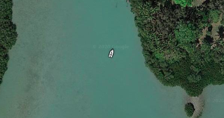
One way to get a feel for what areas are good is to look for boats.
In the picture above, you can see that this boat is fishing the shoreline, so that might be an area worth checking out.
You can also do the same thing with Street View to see where anglers are fishing along a pier.
The Best Way To Use Information From Google Maps
All of this intel you can get for free from your home is great, but it’s only a piece of the puzzle.
You still need to know the trends to really dial in where the fish will be.
And in fact, it’s best if you consider the current trends, and then use this Google Maps information.
Here’s how Luke used this data recently to catch a snook on the first cast in a new spot:
He knew that the trends were that feeding fish are going to be close to the inlets and passes and feeding during the twilight hours around points.
He used Google Maps to locate a pass in the area he was fishing in, then he located a few points.
Once he knew where he wanted to go, he used Street View to find the kayak launch closest to his spots.
Every Friday, Luke puts out a Weekend Gameplan video for our Insiders where he talks about the current trends so you can go and catch lots of fish over the weekend.
If you want access to the Weekend Gameplan videos, plus get all of our best spots and tips, as well as get discounts to our online tackle store, click here to join us in the Insider Club.
Conclusion
I can’t believe how far technology has come to help fishermen!
You used to have to know someone in an area or spend a lot of time out on the water yourself to get this information, but now you can get it all quickly just from using your computer.
Have any questions about using Google Maps to find fishing spots?
Let us know down in the comments!
And if you know someone who would love to learn how to use Google Maps better, please TAG or SHARE this with them!
P.S. Want access to our best fishing spots and tips, plus discounts to our online tackle store? Click here to join us in the Insider Club!
Related articles:


I’ve been holding this page for months and just now looked . Don’t know what platform this works on but on Android in a Chrome browser at google.com/maps there’s no sign of little man, blue lines, or blue dots. The google maps app has a street view ootion though. Imagery at my nearest beach is hit and miss: one user loaded surround view of sand and bridge looks useful, but when was it shot? Further down this same Texas beach I find mountains in the background. Fail! Nowhere is a little man.
Thanks for dropping in on my porch, ya should have stayed for a beer! The platform on the back of the boat is a modern day “walk the plank!” So you better behave and listen to that captain! Great stuff guys! Thanks for sharing.
Hi Luke,
Disregard the previous comment.. …had a talk with the little yellow man and he told me what to do
Hi Luke,
I left click the little yellow man to a spot, release the click and little yellow man jumps back to the lower right corner. What am I doing wrong ?
Hi guys. Love you all & all you do , but how about some help for us in New York, especially Long Island , can you just pick a place on the South Shore of Long Island and show us places , like your Florida Videos , I know it’s the same Procedure, but you guys make it look so Easy , THANKS . Love be a insider From NY👍
Played around new Smyrna, found the insides of a few condo buildings common areas, must be a way to contribute source of you have the right equipment.
That’s crazy, the little man walks the perimeter of all my local spoil islands now.
Hahaha. Little Google man goes everywhere!
Do you have to have a PC or laptop for this feature? I can’t seem to get the little man feature to work on my iPad.
This should work for all PCs and I would assume for tablets too. Were you using the main Google maps system (https://www.google.com/maps)?
Not on my iPad also
When I click your link the little man feature is not there at all. When I pull up smartfishingtides link it’s there but will not let me place him anywhere.
Is this all happening on the iPad?
Yes, I don’t have a PC or laptop. Wondering if I’m missing something or it just doesn’t work on the iPad format.
Doesn’t work my iPad either. Tried your link, no difference.
Suggestions? My iPad goes fishing with me and I would love to use this feature.
What was the online site to check k tides and winds?
Here’s the platform for checking tides, winds, weather, strike score, etc.: https://smartfishingtides.com/
Not sure how good the vetting is. I’ve found pictures of the city out in the middle of a water way!
Haha. That’s pretty funny!