Smart Fishing Spots MASTERY (in 10 minutes)
- By: Joseph Simonds
- on
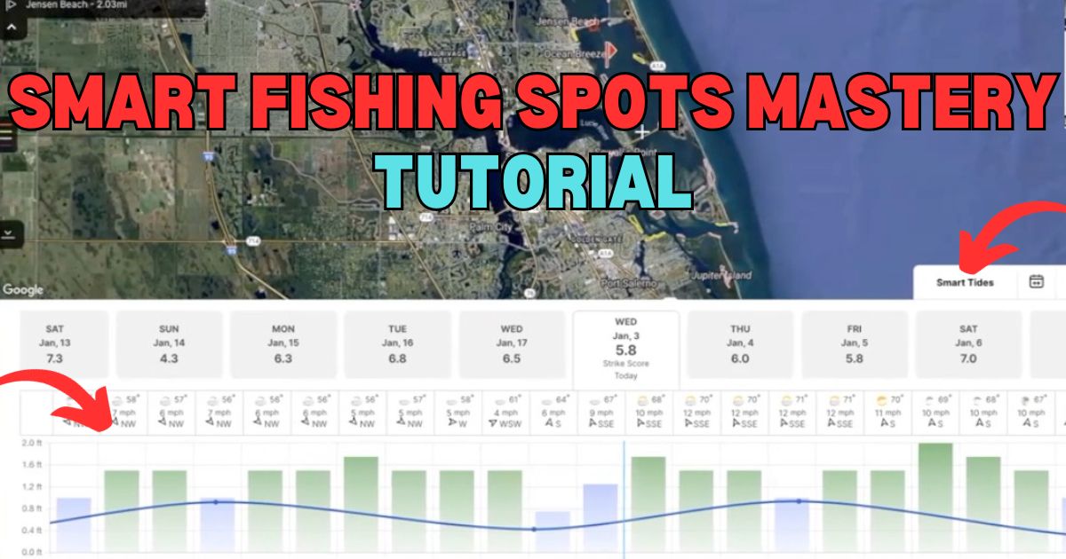
We’ve had a ton of people ask for an in-depth (but still quick) tutorial on how to use every feature of the Smart Fishing Spots app and software.
So we boiled everything down into 10 minutes.
Tight lines and enjoy!
Not a member? Then click here to join the Insider Club today so you can get access to Smart Fishing Spots, discounts on the tackle in our shop, and much more.
Smart Fishing Spots MASTERY Tutorial [VIDEO]
Not a member? Then click here to join the Insider Club today so you can get access to Smart Fishing Spots, discounts on the tackle in our shop, and much more.
Smart Fishing Spots MASTERY Tutorial [PODCAST]

Note: Don’t forget to subscribe to the Salt Strong podcast on iTunes, Stitcher, or Spotify and leave us a review!
Related Podcasts:
Not a member? Then click here to join the Insider Club today so you can get access to Smart Fishing Spots, discounts on the tackle in our shop, and much more.
If you’re not in the Insider Club yet, what are you waiting for?!?!
We can’t wait to unite inshore saltwater anglers in ONE place!!
FINDING THE FISH HELP
In order to help make sure that you are targeting the right areas based on the latest feeding trends and upcoming weather forecasts, make sure to use the following 3 resources because they will save you a ton of time.
1. WEEKEND GAME PLANS (UPDATED WEEKLY)
These regional game plans will show you exactly what types of spots to target in under 10 minutes… just click the video to start, and you’ll be informed on what to do on your next trip.
2. SMART FISHING SPOTS PLATFORM (UPDATED EVERY 15 MINUTES)
This exclusive software literally shows you where the most fish are likely to be feeding based on exactly when you’ll be fishing. It factors in the tides, wind, and weather to help you quickly see which areas to target throughout the day.
3. COMMUNITY REPORTS (LIVE FEED)
The Insider Community platform is what you can use to see what is biting near you, and you can get to know other members who fish in your area. Plus, you can use it to keep a log of your catches so you can use past trips to help predict future catches.
Related categories:
STOP WASTING TIME ON THE WATER!
Do what the “SMART ANGLERS” are doing and join the Insider Club.
Here’s what you’ll receive today when you join:
- Weekly fishing reports and TRENDS revealing exactly where you should fish every trip
- Weekly “spot dissection” videos that walk you through all the best spots in your area
- Exclusive fishing tips from the PROS you can’t find anywhere else
- Everything you need to start catching fish more consistently (regardless if you fish out of a boat, kayak, or land).


 Weekend Game Plan Lessons
I just saw where I can get a waterproof tablet (android) from Amazon for about $200. Is this for real that I can use a tablet with Smart Spots and have the functionality of my fish finder on my kayak? All I need is depth and it would be nice to mark waypoints and track my trips. Have any of the coaches tried this out to verify that it works without a network connection on the water well? Holy smokes this can be a huge game changer!
Here is what I found: AGM PAD P1 10.36 inch Rugged Tablet, Android 13 Tablet, Waterproof/Drop-Proof/Dustproof, MTK G99 Chipset, 2K Display FHD+ IPS, Dual Box Stereo Speakers, 7000mAh, 8+256GB[Expandable to 2TB], GPS, WiFi
https://a.co/d/5bUYfVx
Thanks for sharing the cool idea and the product… seems like a smart play.
Thank you both i refer to this often 👍🏻
I spent a few minutes with the app on Android. The one foot contours will be great for wade fishing. I haven’t figured ouf how to take this alonv with me on the water except to mark up a fishing chart. PROBLEM: the range tool resets to my current position rather than the charted position. How will I get the range overlayed on a chart with the contours (to give me an idea what the compass course and distance are?
Hi Kenneth! If you are using the range tool that is paired with the compass, this can only start at your current position. There is another distance measuring tool (the icon is a ruler) that may help as it allows you to place both endpoints where you would like. Make sure you have the newest version of the app downloaded, and you will find this under Tools. Feel free to reach out to feedback@saltstrong.com if you have any questions or need any assistance!
The contour line layer isn’t showing as an option for me on desktop, only on my phone.
Very odd. Are you certain that you’re using the most up to date desktop version here – https://sfs.saltstrong.com/
Thanks for the reply Joe. That link worked. The reason it was not showing up for me is because when I click on smart fishing spots on the dashboard, it automatically brings me to version 1 of smart fishing spots, but I need to click “preview the new smart fishing spots” to access version 2. It’s my first day on salt strong, so still learning how to use the site!
What are the white + sign and red flag for? Near as I can tell the + sign will reflect the nearest tide station but I can’t figure out the red flag.
The android app version I have only shows smart spots. It doesn’t have the insider or community spots. Also my layers never save when i exit out.
Hey Michael, the app version doesn’t have Insider or Community spots yet. It was slowing the app down quite a bit – plus the Insider/Community spots is more beneficial on desktop for pre-trip planning. As long as you don’t close the app, it should save your layers. Let us know.
You guys just keep taking things to the next level. Thank you for what you do. Are the numbers listed on the 1 foot contour lines during high or low tide?
Thank you, Ferdinand
I asked the same question. Did not get an answer yet.
Sorry about that, Paul. It’s an average (median) tide. These contour lines are less about navigation and more about finding sharp dropoffs.
Hey Ferdinand. The 1-foot contour lines are from an average tide (median)