New 4K Satellite Map Makes Google Maps Look Silly!
- By: Joseph Simonds
- on
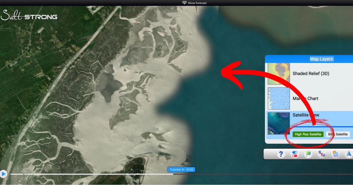
Our new 4K Satellite Map blows Google Maps out of the water!!
The Smart Fishing Spots App just keeps on getting better.
And we aren’t done yet!!!
This is just one more reason to join the Insider Club if you already haven’t.
Learn more about the most recent updates below!!
You can watch the video version of this podcast below (which I highly recommend), listen to the audio version by clicking the play button underneath it, or listen to it on iTunes, Stitcher, or Spotify.
P.S. Don’t forget to subscribe on iTunes, Stitcher, or Spotify and leave us a review!


New 4K Satellite Map [PODCAST]
Note: Don’t forget to subscribe to the Salt Strong podcast on iTunes, Stitcher, or Spotify and leave us a review!


Related Podcasts:
- NEW TOOL ACCURATELY PREDICTS WHERE TO FIND REDFISH & TROUT EVERYDAY!
- THIS IS THE QUICKEST WAY TO FIND OYSTER BARS IN YOUR AREA!
Here is a timestamped version:
- 2:00 – Smart Fishing Spots 4K Satellite Map Views
- 4:10 – Additional Satellite View Options
- 7:38 – Advantages of High-Resolution Maps
- 9:07 – Insider Member Only Content
- 11:22 – Low Tide Imagery
- 13:42 – Progressive Web Apps
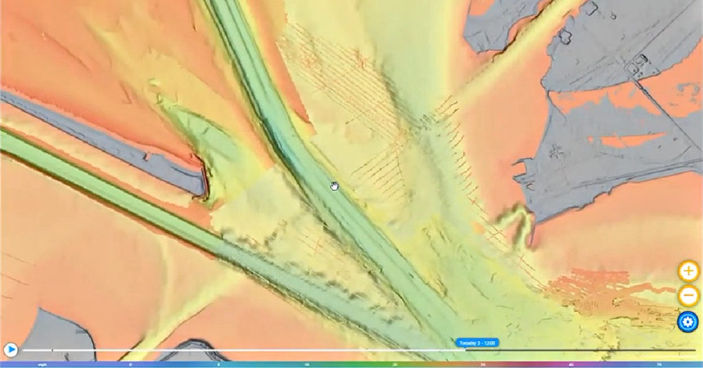
- 14:39 – Underwater 3D Topography Maps
- 17:40 – Weather and Forecast Data
- 18:09 – How To Drop A Marker In Smart Fishing Spots
- 20:14 – NEW Boat Ramps Button
- 22:40 – Join the Insider Club TODAY!!!
- 23:40 – Smart Spots & More
New 4K Satellite Map [VIDEO]


Conclusion
Smart Fishing Spots is quickly transforming the way many anglers within our Insider Club are targeting and catching fish.
Just about everything you can imagine is all in one convenient app that is completely free to you when you join the Insider Club.
What the heck are you waiting for?!?!
If you have any additional questions about Smart Fishing Spots, let us know in the comments!!
And if you know someone who wants to learn more about Smart Fishing Spots, please TAG or SHARE this with them!
Oh, and if you Join the Insider Club TODAY, Smart Fishing Spots is absolutely FREE! Click here to join us in the Insider Club!
Related Articles:
Related categories:
STOP WASTING TIME ON THE WATER!
Do what the “SMART ANGLERS” are doing and join the Insider Club.
Here’s what you’ll receive today when you join:
- Weekly fishing reports and TRENDS revealing exactly where you should fish every trip
- Weekly “spot dissection” videos that walk you through all the best spots in your area
- Exclusive fishing tips from the PROS you can’t find anywhere else
- Everything you need to start catching fish more consistently (regardless if you fish out of a boat, kayak, or land).





Can you use the search feature to search a GPS point and locate it on the map?
Is SOuth Carolina, Beaufort area coming on line soon?
I just looked in your area and Smart Spots is working there. It looks like you have alot of good fishing down there.
Does anyone have any tips on being able to see your phone or tablet while in the water? I can’t see my phone screen at all due to the sun and glare. I tried an iPad in the yard and it’s not much better.
Getting it in the shade is crucial… I’ll often just turn my back to the sun and hold the phone down in my shadow. If a super bright day and I need to see details on the screen, you can even put a towel over your head and hold the phone under its shadow for a very clear picture.
Thanks for the tips, and Salt Strong. It’s amazing how accurate the Smart Spots app is. It is marking spots that I have fished for years. I can’t wait to try the new spots that I never knew about.
Large round brim hat 20″ across helps keep my phone in the shade and easier to read on my Kayak.
This is a great resource! Any idea when oyster bed locations will post for NC?
We unfortunately can’t give a specific date because it’s a ton of data to populate… it’s high up on our priority list, so hopefully soon.
Looks great. Any plans to add these features in Maryland?
Yes, the 4K satellite view is up in Maryland now. Are you not seeing it when you are zoomed in?
When I set the flag and change from wind to waves, the data is showing up in meters. Where’s the control to change to feet? No doubt about it, the 4K is is unbelievably cool…
Hey Art, Which layer is showing meters? We checked all the layers under waves and they all show feet. Send a screenshot to feedback@saltstrong.com and we’ll check.
Maybe it was just an anomaly. While this morning I couldn’t get rid of the meters display, now I’m unable to duplicate it. If it comes up again, I’ll send a screenshot. No worries… It’s all GOOD!
This is very cool. After playing with it I have a couple of questions:
1) Is there a way I can make the app take up all of my computer screen? I still have my tabs visible when using the app and about one inch of useless real estate that I would like to dedicated to the app view.
2)Is there a way I can move the Map Layers rectangles in the lower right hand side around? Can you build it where it can come down like the weather ribbon so I can get as much of the total screen dedicated to the map?
3) Can you set it up so when I develop my settings I can save the view and have it be my default when I come back into the app? This would save a lot of time of having to remember what settings I had the last time I was in the app?
Just some end-user thoughts….
Hey Steven, The app should be full screen by default. Email a screenshot to feedback@saltstrong.com and we’ll take a look.
To hide the map layers, just click the gear icon, which will allow for a full screen view of the map.
We’re actually working on a feature that will allow you to save ‘presets’ of the various layers and transparencies so you can easily switch back to those saved settings.
Thank you for your feedback!
Can we get this for the San Francisco Bay area?